

Pläne für Lichtsignalanlagen
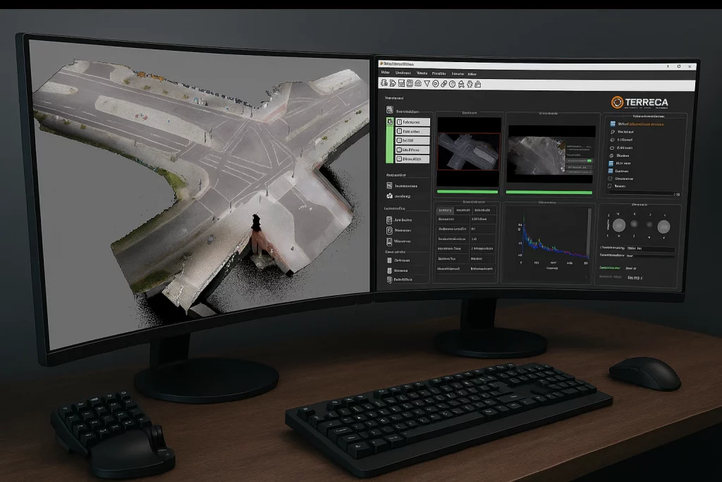
Terreca creates digital twins of road intersections and converts them into data-driven 2D traffic signal layout plans.
20 years of development:
—from geo-referenced on-site capture through standardised plan production to data analysis.
Precise · efficient · cost-effective
Mehrwert für
Traffic signal contractor
Integrieren Sie Terreca als Leistungsmodul – und bieten Sie Bestandsdaten, Planunterlagen und Nachweise schlüsselfertig an.
Municipalities
A standard that accelerates projects: comparable data, clear acceptance, and faster Smart City delivery.

Planning
Standardised, reliable data: fewer follow-up questions, faster processing, and reduced project risk.
End-to-end process
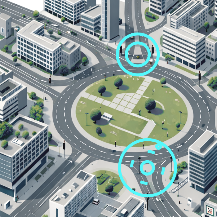
From the real-world site conditions, a consistent, verifiable traffic signal layout plan is created—providing a robust foundation for design, construction, and digital downstream use; fast, repeatable, and scalable.
Process chain · standardisation · foundation
Resultate
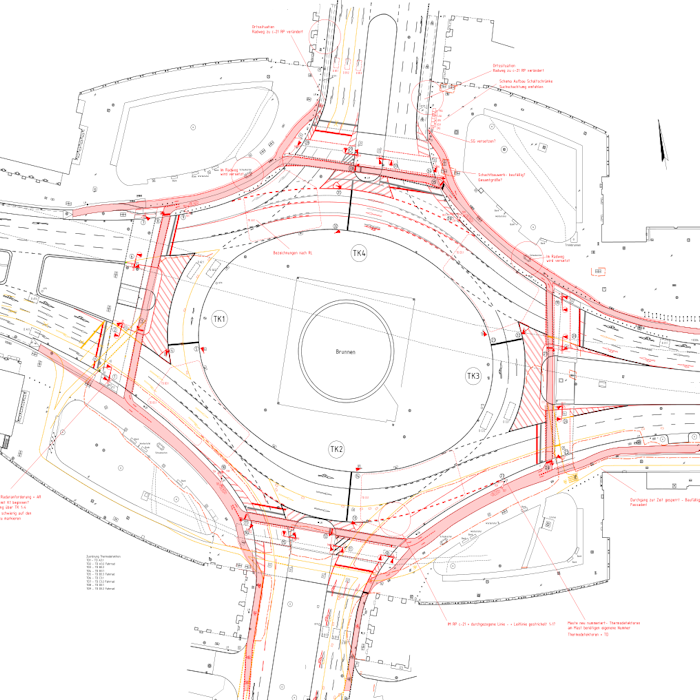
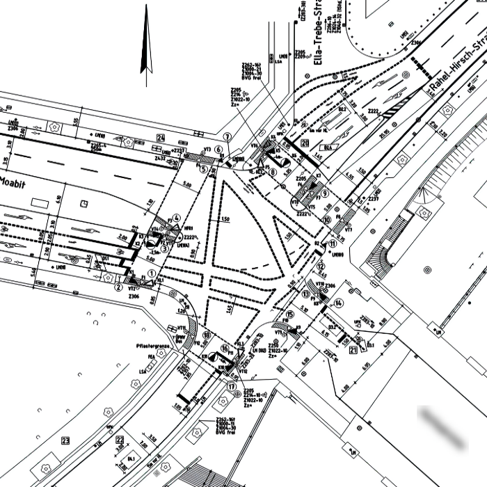
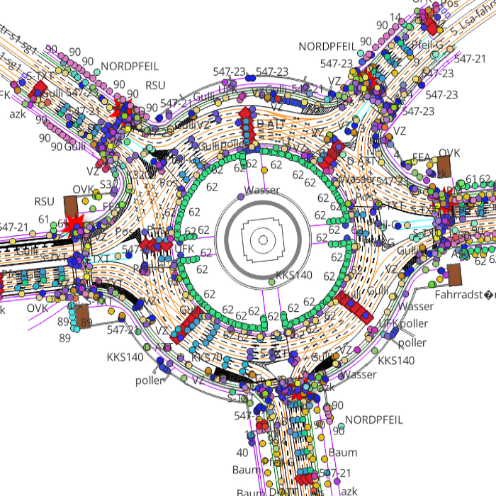
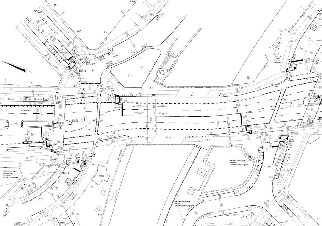
Traffic signal layout plan
Standardised and data-ready—as a reliable planning baseline.
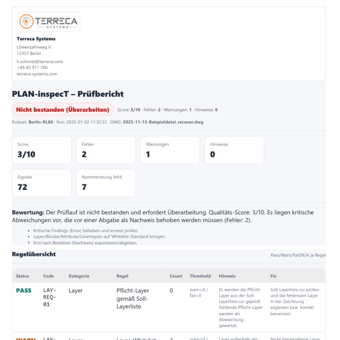
Validation report
Clearly documented—for acceptance, compliance evidence, and analysis.
Data exports
Process-driven
GIS, LV/Kalkulation, MAP
System Terreca
① Capture
Precise on-site surveying
- Geometry & position (3D)
- Signal equipment and installed assets
- Geo-referencing
② Standardise
Standardised structure & verification
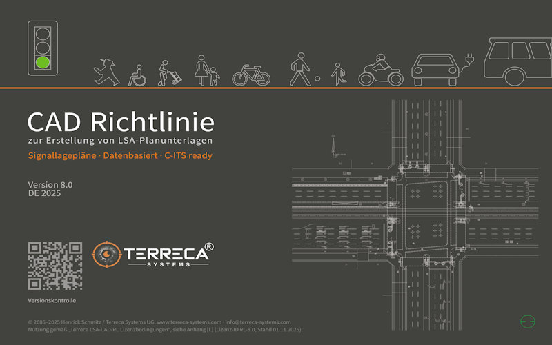
- Richtlinie 8.0 CAD-Standard
- Rule-based checks
- Rule-based checks
③ Analyze
Project-ready deliverables
- 2D traffic-signal layout plan
- Verification record / report
- Lists & data exports
Terreca Toolkit
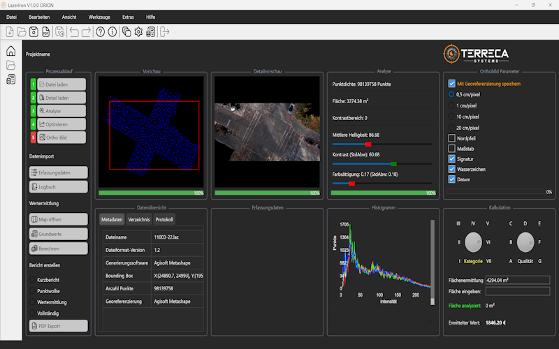
Terreca LazerIron v1.1
Data preparation for CAD
CAD-Standard v8.0
Drawing standardisation
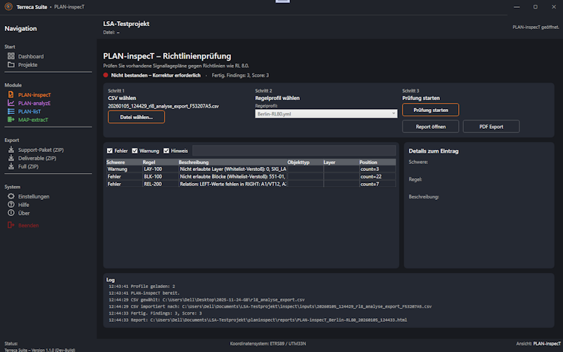
Terreca Suite v1.0
Verify, document, export
Proven experience from real-world projects
Terreca is built on more than 20 years of hands-on experience in traffic-signal (LSA) documentation and CAD standards.
Dieses Know-how steckt direkt in der Erfassung vor Ort,
der CAD-Richtlinie 8.0 und den Terreca Software-Modulen – damit Daten verlässlich, konsistent und über Projekte hinweg vergleichbar bleiben.